
Overview
A geofence is an area you draw on the map, such as a depot, yard or customer site. The platform records when vehicles enter and leave it, and shows the geofence name on the timeline and in reports.
Before You Begin
Before you start, make sure you have:
- Access to the V-DAQ platform.
- Permission to manage geofences in your account.
Important
The Geofences page described here is the new map editor. If your platform still shows the older geofence table, these steps will apply once the new editor is released to your account.
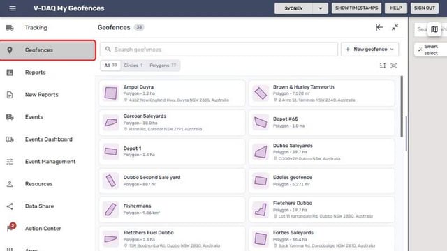
Step 1 – Open the Geofences Page
Select Geofences in the side menu.
Step 2 – Get to Know the Page
The page has a list on the left and the map on the right. Each list entry shows the shape, its area and the nearest address.
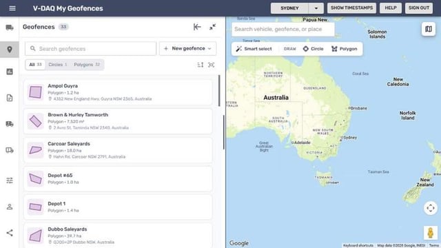
| Control | What it does |
|---|---|
| Search geofences | Find a geofence by name. |
| New geofence | Start drawing a new geofence. |
| All, Circles, Polygons | Filter the list by shape. The count shows beside each. |
| Sort geofences | Sort by name or size. |
| Show all geofences on the map | Zooms the map out to fit every geofence. |
| Three dots beside a geofence | Edit, Zoom to, Duplicate or Delete. |
Related Articles
Need More Help?
If you're still experiencing issues:
Phone: (02) 4204 8472
Email: support@v-daq.com.au